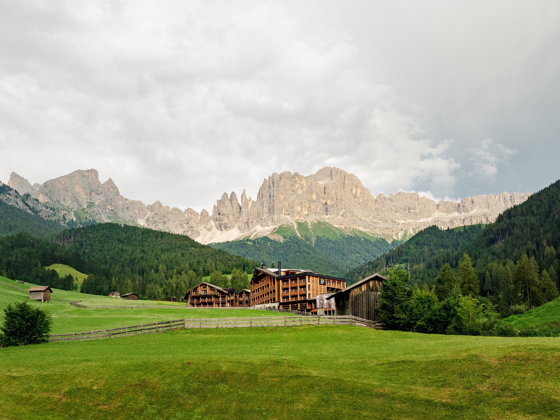
Professional Drone Photography & Aerial Services Edinburgh & Scotland
High-quality drone photography, videography, and survey support for property, construction, and commercial projects across Scotland.
Edinburgh Drone Photographer — Joe Liddell
With 10+ years of drone expertise, I create stunning aerial photography, videography, and survey visuals that win contracts and drive leads. Specialising in aerial photography Scotland-wide, drone surveying, topographic mapping, and construction progress surveys.
Blending technical precision with cinematic quality, I help property, construction, commercial clients, and developers stand out. Drone photographer Edinburgh, serving Glasgow, Aberdeen, Inverness, the Highlands, and all of Scotland.


CAA/EASA Certified
Fully licensed and insured, I ensure a seamless, professional process from take-off to final edit.
Drone Photography & Survey Services Across Scotland
Construction Progress Surveys
Monthly drone surveys that keep your site records accurate and your stakeholders informed. Fast turnaround, professional reports, and flexible retainer packages for contractors across Scotland.
Roof & Structural Inspection
Safe, detailed visual inspections of roofs, facades, and hard-to-reach structures. High-resolution imagery and a written report delivered within 48 hours — no scaffolding required.
Aerial Photography & Videography
Aerial imagery for property, land, and commercial projects. High-resolution 4K video and 20MP photography delivered fast — covering Scotland and Northern England.
Accurate orthomosaic maps, elevation models, and 3D terrain data for planners, developers, and engineers. Professional survey deliverables without the land surveyor price tag Available for drone survey Scotland-wide, including Edinburgh, Glasgow, Aberdeen, Inverness, and the Highlands..
Stockpile Volume Measurement
Cinematic drone footage for weddings, rural estates, tourism campaigns, and outdoor events across Scotland. Covering the Highlands, Borders, Edinburgh, Glasgow, Inverness, and beyond.
Event, Estate & Tourism Filming
Precise volume calculations for quarries, earthworks, and aggregate sites — completed in under an hour on site. A fraction of the cost of a traditional land survey, with the same professional output Serving quarry operators, earthworks contractors, and aggregate companies across Scotland..
Drone Survey & Topographic Mapping

“Joe’s drone photography and videography exceeded our expectations. His eye for detail and ability to capture the beauty of our resort was fantastic.”
Fiji Marriott Resort

"We’re really happy with the content—everything worked perfectly, and it was a pleasure collaborating with Joe."
Cyprianerhof Dolomit Resort
★★★★★
★★★★★
Areas Covered
Based in Edinburgh, Joe Liddell provides professional drone photography, aerial videography, and drone survey services across Scotland and Northern England. Areas regularly covered include Edinburgh, Glasgow, Aberdeen, Inverness, Dundee, Perth, Stirling, St Andrews, Fort William, Aviemore, and the Highlands. Also serving the Scottish Borders, Dumfries & Galloway, Argyll & Bute, Moray, Aberdeenshire, and the Orkney & Shetland Islands by arrangement. Northern England coverage includes Newcastle, Leeds, Manchester, and Sheffield.
Frequently Asked Questions
How much does drone photography cost in Scotland?
Drone photography in Scotland typically costs £300–£500 for a half day and £400–£700 for a full day. Drone survey services such as topographic mapping and stockpile volume measurement start from £400. All prices include CAA-licensed operation, professional editing, and fast turnaround.
Do you cover the Highlands and rural Scotland?
Yes. Joe Liddell covers the full length of Scotland including the Highlands, Aberdeenshire, Argyll, Moray, the Scottish Borders, and island locations by arrangement.
What qualifications do you hold?
Joe Liddell holds a GVC (General Visual Line of Sight Certificate) — the UK CAA standard commercial drone licence — and full public liability insurance. All flights are conducted safely and legally.
Can you do construction progress surveys on a monthly retainer?
Yes. Monthly construction site surveys are one of the most popular services offered, providing project managers and developers with regular orthomosaic maps, progress photos, and written reports. Retainer packages are available with fast 48-hour turnaround.
What is stockpile volume measurement and how much does it cost?
Stockpile volume measurement uses drone photogrammetry to calculate the exact volume of materials such as aggregate, soil, or waste on a site. A traditional land survey costs £800–£1,500. With drone technology, the same result is delivered in under an hour on site for £300–£600, serving quarries, earthworks contractors, and aggregate companies across Scotland.
Let's work together
+44 7775 270977
joe.liddell.photo@gmail.com
© Joe Liddell Photography · Edinburgh, Scotland